Northumberland and its names
c. 1860, as recorded by the
first Ordnance Surveyors:
images and transcriptions

Northumberland and its names
c. 1860, as recorded by the
first Ordnance Surveyors:
images and transcriptions
The Ordnance Survey Name Books are handwritten documents recording fieldwork on a very grand scale. They offer fascinating glimpses of the landscape, antiquities, buildings, and industrial and social history of the mid 19th century — a time of great change — and reveal how places and place-names were mapped and recorded for posterity.
Written in the years around 1860 by Royal Engineers surveyors and civilian assistants, the Name Books formed an essential basis for the First Edition Six Inch maps and subsequent maps up to our own time. As well as verifying and recording over fifteen thousand Northumberland place-names from Abberwick to Youly Sike the teams gathered snippets of local information, scratched their heads over archaeological sites, and consulted histories and directories of the county. The short ‘Descriptive Remarks’ they wrote contain a wealth of local information that often goes far beyond the needs of mapping.
Since 2016 the dedicated volunteers of the Northumberland Name Books project have digitised and transcribed all 104 surviving books, and images and transcriptions can be browsed and searched on this website. Please see ‘The Project’ for full acknowledgement of all involved. It is hoped that the background materials on this website will provide useful context. Unless otherwise stated, they are the work of Diana Whaley, Emeritus Professor of Early Medieval Studies, Newcastle University.
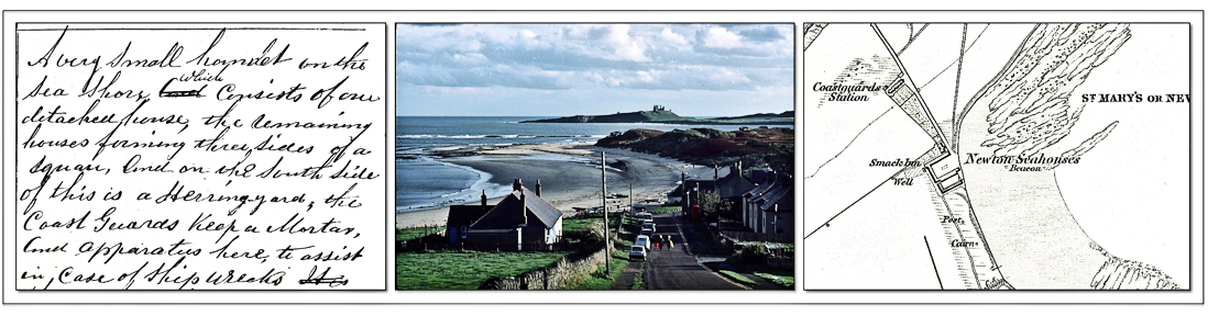
Newton Seahouses (now Low Newton by the Sea), as described in the OS Name Book for Embleton