[Simonburn Index 1 of 1]

[OS34/412]

SIMONDBURN PARISH

Object Page Object Page Object Page Object Page Object Page Object Page
Allgood Farm 11 Dove Cot 13 Haughton Castle 57 Little Lonbrough 24 Ringhilt Plantation 15 The Mains 53
Ark Hill 98 Dobbs Hill 33 Haughton Mill (paper) 58 Longridge 47 Ranterrear Wood 17 The Red Lion PH 53
Druidical Temple (site of) 50 Haughtonheugh Wood 59 Lady Well 49 Ranterrear Burn 17 Todd Crags 62
Broadpool 5 Davy’s Lee 80 Haughton Heugh 59 Longrack Ford 60 Red Burn 29 Thatch Sike 67
Bleaklaw 12 Hoglair Hill 64 Lough Rigg 71 River North Tyne 46 Tathy Knowe 70
Boat Banks
(Click page numbers)
14,43 East Stonefolds 78 Haughtongreen 65 Long Rigg 84 Rushy Rigg 64 Town Shields 85
Bankfoot Cottage 16 Ewe Crag 89 Hawk Sike 67 Long Green 87 Roman Wall (Remains of) 95 Tepper Moor 92
Barley Hill 23 East Cockplay 110 Haughtongreen Burn 68 Little Crag 89 Rye Hill 111 Tecket Linn 92
Burn House 33 Haughton Common
(Click page numbers)
69,83 Long Crag 90 Red Lion 121 The Parsonage 117
Broadpool Common 35 Fox Green 24 Halleypike Lough 79 Low Teppermoor 97 The Crown PH 118
Brown Rigg 64 Fenwickfield 28 Harraway Hills 81 Leazes Head 111 Shaw Plantation 11
Blue Bog 65 Fairshaw 48 Hemmel Rigg 103 Lincoln Hill 120 Standingstone Rigg 22 Uppertown 48
Black Carts 69 Fold Hill 88 Hatheridge 109 Snipe Wood 27
Bellcrag Flow 70 Fozy Moss 107 Humshaugh Fell 110 Mount Farm 27 Simondburn Common 30 Wester Hall 58
Banna Crag 88 Haughton Pasture 110 Muggers Well 49 Simondburn Castle (Remains of) 37 West Stonefolds 78
Black Carts 98 Glen Ridley 1 Halfway Houses 112 Mid Town 58 Slaterfield 41 Well Rigg
(Click page numbers)
85,89
Black Dike (site of) 105 Goftonburn Bridge 1 Hebberley Bridge 112 Molly’s Stone 63 Simond Burn 49 West Cockplay 98
Gofton Burn 1 Humshaugh 117 Molly’s Stone Sike 67 St Simons Church 50 Walwick 119
Coal Burn 7 Goatstones 7 Humshaugh House 118 March Sike 71 Simondburn Bridge 54 Walwick Hall 119
Corn Shield 10 Greenhaugh 27 Humshaugh Burn 118 Meggy’s Bower 75 Simondburn 55 Waterside 120
Chipchase Ford 13 Garden House 43 Humshaugh Mill (Corn) 121 Meng Sidke 80 Strother 60
Castle Burn 28 Greenend 48 Humshaugh School 123 Middle Rigg 87 Snipe Crag 61    
Carkey Linns 31 Greenlee Burn 61 Hopewell 123 Mains 115 Snipe Knowe 66    
Castle Lane 34 Game Cleugh 61 Mains Wood 116 Sell Burn 79    
Cowden Plantation 47 Green Carts 69 Inner Hawk Side 68 Stooprigg 91    
Cowden Cairn 47 Greenlee Lough 77 Nunwick 43 Sharpley 97    
Chapel (Remains of) 57 Green Hill 85 Kimmins Cross 19 Nunwick Bridge 44 Sewingshields Crags 103    
Coldwell 59 Green Carts 99 Kirk Shield 30 Nunwick Mill (Corn) 46 Sewingshields Castle (Site of) 103    
Coldwell Wood 60 Kennel 44 Nunnery (site of) 52 Styden Wood 111    
Crowcrags House 65 Hemmel Heads 9 Kinglish Crag 60 New House 124 Simondburn Cottage 115    
Crow Crags 68 Harvest Green 22 Kings Crags 75    
Cairn Hill 70 Haggle Rig 26 Kingscrag Gate 76 Parkend 15 Throughgates 15    
Coldknuckles 79 Hopeshield Burn 29 King Wanless Green 106 Parkside Wood 16 The Lumps 21    
Crook Burn
(Click page numbers)
82,91 Hall Barns 39 Keeper Shield 109 Parkside 17 Townshield Bank 22    
Camp (Remains) 101 Horsleyhill Plantation 45 Proctors Bridge 56 The Carts 24    
Cat Gate 102 Hall Bank 51 Linn Hirst 9 Proctors Burn 34 Tecket 31    
Church (Perpl Curacy) 115 Low Parkend 13 Pinch Park 80 Tecket Dean 31    
Cowper Hill 120     Lonbrough 23 Post Office 117 Torley Banks 33    
Chollerford (The George Inn) 124     Lonbrough Plantation 23 Townhead 44    
Chollerford Bridge 124     Queens Crags 75 Turnbullhill Plantation 45    
        The Park 45    
                The Rectory 53    
                   

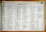
Read the first page of the transcription

Abbreviations are underlined like this RE and the expansion may be seen by hovering the cursor over the abbreviation.

An entry outlined like this has a note which may be seen by hovering the cursor over it.

Transcribed by MCB and DW