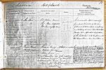
| < | List of Names as written on the Plan |
Various modes of Spelling the same Names |
Authority for those modes of Spelling |
Situation | Descriptive Remarks, or other General Observations which may be considered of Interest |
> |
|---|---|---|---|---|---|---|
| The Low | The Low | R.S.Bolam, Barmoor | On Sheets | A considerable Stream originating | ||
| The Low | Thos Main, Haggerston | 11.2, | from small tributaries on the farm | |||
| The Low | Wm Lowrey Esqr., Barmoor | 11.6, | of Lowick South Lowstead, and flowing | |||
| 11.10 & | in a Northerly direction till it Unites with | |||||
| 11.14 | Bowsden Burn; after which it takes the Name | |||||
| of "The South Low" to its Confluence with | ||||||
| the German Ocean – Near Brock Mill | ||||||
| ROMAN ROAD | Roman Road – | Alexander Craig | On Sheets 11.1,5,10,14&15.2 | Scarcely any trace of this Ancient military Way | ||
| (Devil’s Causeway) | (Devil’s Causeway) |
Nicholas Kennedy – S. Berrington | now exists in the Parish of Lowick. Mr Alexr Craig | |||
| (Site of) | (Site of)[*] | of Brownridge has pointed out its course across | ||||
| Roman Road – | his farm, where it has been removed in tilling, a quantity | |||||
| Do | John Todd | of Rubble still indicating its site. Faint vestiges of it | ||||
| Henry McLauchlan Esq -}who supplied | appear in two fields on South Berrington, where a | |||||
| late Ordnance Surveyor}a trace of this | quantity of small stones are turned up in its course | |||||
| 3 Kennington Row }road from a | by the plough, as pointed out by Mr. Nicholas Kennedy. | |||||
| Kennington Park }careful survey | Mr. John Todd of Berryburn, pointed it out that | |||||
| London S. } | a Well on North Berrington, where it was supposed a | |||||
| portion of it was Come upon, when sinking a drain. | ||||||
| There is no indication of it on the farm of Lickar. | ||||||
| John Callanan 2nd Corpl RE | ||||||
Note: Signature in header ('Described by')
Abbreviations are underlined like this RE and the expansion may be seen by hovering the cursor over the abbreviation.
| An entry outlined like this has a note which may be seen by hovering the cursor over it. |
Transcribed by SCS and BFR
Return to Lowick index