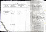
| < | List of Names as written on the Plan |
Various modes of Spelling the same Names |
Authority for those modes of Spelling |
Situation | Descriptive Remarks, or other General Observations which may be considered of Interest |
> |
|---|---|---|---|---|---|---|
| The Devil’s Causeway | Devil’s Causeway | Mr Patterson | About 13 Chains E of | This is a portion of the celebrated Roman Road | ||
| ROMAN ROAD | Devil’s Causeway | Mr Telford | Todburn | called the Devil’s Causeway which branches off | ||
| (Remains of) | Devil’s Causeway | Mr Laughlins Survey | Watling Street in a North Easterly direction at a | |||
| ROMAN ROAD | place called port Gate near Corbridge it keeps | |||||
| (Remains of) | nearly a Northern direction throughout this Parish | |||||
| and in many places where the ground has been broken | ||||||
| for draining and fencing purposes the paving stones | ||||||
| are quite visible, its course is also tracable through | ||||||
| many of the cultivated fields where it is known by a | ||||||
| slight swell in the ground and a considerable difference | ||||||
| in the appearance of the vegetation along its course, | ||||||
| From the existing remains it appears to have been | ||||||
| about 40 links in width | ||||||
| Linden Gill | See Name Book of Sheet 54/3 | |||||
| Edw. Gillespie SRE |
Abbreviations are underlined like this RE and the expansion may be seen by hovering the cursor over the abbreviation.
| An entry outlined like this has a note which may be seen by hovering the cursor over it. |
Transcribed by AOS and PAF
Return to Longhorsley index